Thin slices of intelligence – meet the bot ‘Blakeley Raise’

Timing Kindle cover
Timing Kindle cover

The first part of this blog talks about background, so if you’re keen to read instead about my new chat-bot Blakeley Raise, just skip down a few paragraphs… I’m very excited about Blakeley Raise, and hope you’ll check out the new possibilities. If you can’t wait to give it a go, click here.

So, the background… I had the great pleasure of going to the technical day of the Microsoft  London Future Decoded conference last week. It was packed with all kinds of interesting stuff – far too much to take in in the course of a single day, in fact. There were cool presentations of 3d technology – the new Hololens device, enhanced ways to visualise 3d objects within a computer, and how 3d printing is shaking up some parts of the manufacturing industry. And lots of other stuff.

HAL 9000 from 2001 - A Space Odyssey (Wiki)
HAL 9000 from 2001 – A Space Odyssey (Wiki)

But it all threatened to be a bit overwhelming, so I kept my focus quite narrow and stayed mostly with the AI stream of presentations. Top level summary: Slate (in Far from the Spaceports and Timing) has no need to worry about the competition just yet, but there is some really interesting work going on. It will take a lot of generations for Slate to emerge! But the work that is being done is genuinely exciting, and a mixture of faster hardware, reliable communications, and good programming practice means that some tasks are now trickling into general everyday use.

One speaker used the phrase “slices of intelligence” to capture this, recognising that real intelligence involves not only a capacity to learn tasks and communicate visually and in words, but also to reflect on success and failure, set new challenges and move into new environments, interact with others, be aware of moral and ethical dimensions of an action, and so on. We are a very long way from producing artificial intelligence which can do most of that.

Blakeley Raise icon
Blakeley Raise icon

But within particular slices lots of progress has been made. Natural language parsing is now tolerably good rather than being merely laughable. Face recognition, including both identity and emotion, is reasonably accurate – though the site http://how-old.net/ produces such a vast range of potential ages from different pictures of the same person that one can be both flattered and disappointed very quickly (give it a try and you will soon find the limitations of the art at present). On a philanthropic note, image recognition software has been used to provide blind people with a commentary of interesting things in their immediate neighbourhood: see the YouTube snip at the end of this blog.
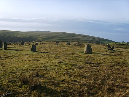
Kinninside Stone Circle at Blakeley Raise, Cumbria (Wiki)

Here’s the bit about Blakeley Raise… For those of us who develop our own software, it is an exciting time. It is extremely easy now to develop a small program called a chat-bot which can be incorporated not just into web pages, but also message applications like Skype, Facebook Messenger, and a host of others. So inspired by all this I have started developing Blakeley Raise, a bot who is designed to introduce potential readers to my books. You can think of Blakeley Raise as a great-great-ancestor of Slate herself, if you like, though I don’t think Slate will be feeling anxious about the competition for a long time yet.

But one of the great things about these bots is that they can be endlessly reconfigured and upgraded. Right now, Blakeley Raise just works by recognising keywords and responding accordingly. Type in “Tell me about Timing” – or another sentence containing the word “Timing” and you’ll get some information about that book. To find out more, navigate your browser to http://www.kephrath.com/trial/BlakeleyRaise.aspx and see what happens. All being well – meaning if I can solve a few technical problems – Blakeley Raise will soon appear on other distribution channels as well. (For those who remember the episode where a Microsoft bot quickly learned how to repeat racist and other inflammatory material, don’t worry – Blakeley Raise does not learn like that)

Finally, here’s a video of one of the more philanthropic spinoffs from Microsoft’s enthusiasm about AI in practical use…


A good start for Timing

Timing Kindle cover
Timing Kindle cover

Only a short blog this week as lots of other things are pressing in… and it’s all about Timing.

First, paperback copies are now available to go alongside Kindle ones, and Amazon (USUK and anywhere else) have joined it all up so you can find the different formats easily.

Then The Book Depository is now stocking it, which is good because they do world-wide free delivery. So if you’re not an Amazon Prime customer, or you live somewhere where Amazon charge for delivery, this is an option.

Finally (for today) the first review is now in, at the Breakfast With Pandora blog. Among other nice things, the review says

So here he is, Mit, a dashing yet ethical nerd, threading his way through entanglements virtual, emotional, and both at the same time, while hunting down the shadowy anarchist group “Robin’s Rebels” and sending down versions of new software written on the fly to his superiors, with the obligatory “interim release note.”

It’s all in the timing, and it’s a grand time…

Guest blog at Dawlish Chronicles – South-West England’s Gigs

This is a guest blog I wrote for Antoine Vanner’s Dawlish Chronicles – follow the link for the original in context. The part at the end where I talk about Dawlish refers to Antoine’s protagonist, Nicholas Dawlish, who is a Royal Naval officer in the latter part of the 19th century. I have reviewed several of his books before, and am looking forward to reading the latest, Britannia’s Amazon, available now in paperback and shortly in Kindle.

Antoine has kindly given me space today to talk about gigs and their use in south-west England, specifically the Scilly Isles and Cornwall. So far as I am aware these have never been used in war, but their history is no less exciting or varied for that.

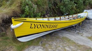
Gig Lyonnesse on St Agnes

First, what is a gig in this context? Picture something that looks roughly like a clinker-built rowing eight. Keel to gunwale depth is around two feet, and once crewed, the waterline is almost exactly at the mid-point. At 32′ long, just under 5′ beam, but with elm planks only 1/4″ thick, the boat is light enough that the crew can pick her up and carry her into the water. Many years of experience mean that a gig has been built robustly enough to take on the Atlantic swell, despite the apparent flimsiness.

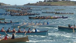
Like an eight, each oarsman has a single oar, and they sit to row alternately port and starboard facing the cox’n. But curiously, they have only six rowers, reflecting part of their history. A mast and lugsail could be fitted if desired, though in commercial practice this was rarely done. They are fast, tough little boats, and at one stage played a crucial role in the economic livelihood of the islands. Today they have retired from commercial use, but have found a new lease of life in competitive sport. The annual world gig racing championship is held on Scilly every April/May. In 2016 it attracted more than 150 boats from many different countries.

Some of the 3000+ rowers in the 2016 races (ITV West Country)

We can trace the history of the gig back to 1666 at least, when vessels from St Mary’s were involved in rescuing the crew of the Royal Oak, wrecked out at what is now the Bishop Rock lighthouse. We have no reason to suppose there were not earlier vessels of essentially the same pattern. All modern gigs are based on the lines of an early 19th century design by William Peters. They had two principal uses, the main one being to get local pilots out to incoming ships as quickly as possible. Whoever got there first got the contract, hence the need for speed. Scilly was one of the major landmarks for vessels inbound from the western trade routes, but the seas are treacherous here, with countless rocks and reefs. Even with modern navigation aids they are hazardous: how much more so in former days? So families or village groups would aim to spot new arrivals as early as possible, and get out to them as quickly as possible.

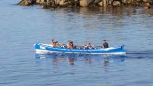
The St Agnes gig, Shah

The other use, more humanitarian than commercial, was as a kind of early lifeboat system. Gig crews over the years have saved a great many lives by going out – frequently in horrendous weather – to rescue crews and passengers suffering shipwreck. Cargo could also be brought back, and an 1887 rescue of 450 cattle from the Castleford involved lashing the animals’ heads and horns to the sides of the gigs Gipsy and O&M, and towing them to a handy nearby island! Such rescues were fearfully dangerous acts, and the churches on Bryher, St Agnes and elsewhere remember many who never returned.

Now, gigs came to the attention of the revenue authorities, who suspected that they had a third use – for smuggling. Certainly they would have been capable of it, with their proven seagoing capability. Even the Cornish coast was within a day from the Scilly Isles for a good crew – the 40-odd mile trip to Penzance typically takes under 10 hours, and Newquay was within comfortable reach. Gigs could easily make the 250-mile round trip to France’s Breton coast by staying out at sea for a day or so, and were robust enough to cope. Bonnet (of which more later) rode out a thirty-hour storm on one such trip by keeping head to wind until conditions improved. A good crew can sustain speeds of around 7 knots, but speeds of nearly 10 knots have been recorded over a measured mile with racing crews rowing at 40 strokes per minute. But therein lay a problem – an eight-oared gig was faster than the customs cutters of the time. This was clearly unacceptable, so a law was passed in 1829 limiting the crew to no more than six oars per boat.

Time passed, and both piloting and rescue ceased to be the responsibility of the islanders. The last recorded pilotage was in December 1938, when the Bryher boat Gipsy went out from St Agnes. As for rescue, the last known one was of the Panamanian steamship Mando in 1955. For a time, it seemed possible that gigs in the traditional sense would die out. Some of the older craft were laid up in storage, others suffered the usual fate of wooden boats which are not constantly cared for.

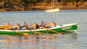
Bonnet pulling ahead of Golden Eagle

Then competitive racing emerged, giving a new lease of life to the design. Informal races had been part of gig culture for a long time: now it has become organised. Inter-island men’s, women’s and mixed races take place weekly during the tourist season, quite apart from the challengers coming from further afield. And here, the robust nature of the vessels is once again proved. Bonnet still races today – she was built in 1830 and had a long and busy working life. She is heavier than her modern siblings, but if there’s a bit of a sea this might not be a disadvantage. Back in August, I saw her beat a dozen other boats to win her race. The Cornish gig Newquay was built back in 1812, and is claimed to be the oldest ship afloat which is still being used for broadly the same purpose as when she was made. Appropriately, she is owned by the Newquay Rowing Club, who also look after Dove (1820) and Treffry (1838) – all still racing.

So, this brings us to Antoine’s own protagonist, the naval officer Nicholas Dawlish, and the timeline set out for his life. Bonnet had been working for 15 years when Dawlish was born in December 1845, and for over fifty years at the time of Britannia’s Spartan. There’s a fair chance that Newquay was built before Dawlish’s father was born. On the assumption that Dawlish passed the Scillies at some stage during early career – and it would be wildly improbable if he had not had cause to see them at close quarters – he would have seen gigs in active commercial use. I wonder, with his eye for design, if he took the time to appreciate their blend of speed, strength and elegance?

Finally, for those who want to look at videos, this video has the 2016 men’s final and lots of links to other clips:


When the earth moves under your feet

Today’s blog was written as a guest post at The Review.

In Britain, we’re used to history – and historical fiction books – where the terrain is basically the same as today. The human presence on the surface might well change, so that towns and cities grow, old buildings turn to ruins, rough tracks turn into railway lines, and so on. Or we might alter the clothing of vegetation – marshes are drained, forests felled, or fertile land turns to peaty bog. But we generally feel here in England that the bones of the landscape itself remain the same on a human timescale. We expect the land to change form only over geological timescales.

Mt St Helens before and after (USGS images)

Other people though, in other parts of the world, have a different expectation. Earthquakes, volcanoes and tsunamis can not only cause loss of life or damage to property, but can reshape the terrain. Mount St Helens was reckoned to be one of the most attractive of the Pacific Rim volcanic cones until May 18th 1980, when the eruption removed over 1/8 of the volume of the former cone. Iceland gained a new island in November 1963, when Surtsey emerged from the waves as a result of subterranean action.

But often we Brits think of that as something which happens in other lands. But actually there are signs of change in counties like Norfolk and Lincolnshire. Near to Cromer, several villages named in the Domesday Book or other more recent records are now up to half a kilometre out to sea. There is evidence that the Lincolnshire coast was, until the 13th century, protected by a chain of offshore barrier islands. The demise of these in a series of storm surges drastically altered the coastline and its vulnerability to the sea. But despite these signs here in our own land that our not-so-distant ancestors walked across a different landscape, it takes a bit of adjustment.

The geology is quite straightforward. During the last ice age, a little over 10,000 years ago, a hugely heavy layer of ice pressed the land downwards, to a greater degree in the colder north than the warmer south. When the ice melted, two things happened. The sea level rose because of extra water. But also the land shifted. The land in places where the ice had been heaviest started to lift up. Outside that, further south, it started to sink down. Try placing a heavy book on a soft cushion and you’ll see the effect in action.

Now, 8000 BC is not all that long ago, really – the Neolithic Age, and so the beginnings of recognisably complex society started not all that much later, around 5000 BC. And although the vertical movement of land in any one year is tiny – perhaps a few millimetres – over the course of a century it adds up. Our Neolithic and Bronze Age ancestors in some parts of the country experienced quite different terrain.

Aerial view of the Scilly Isles (Wiki)

In the north, where the land has lifted, we find settlements which used to be on the coast now stranded well above the waterline. Stone circles at the southern end of Coniston Water, in Cumbria, used to be close to an arm of the sea reaching in from Morecambe Bay, but are now over five miles from the coast.

But in the far south, in the Scilly Isles, we see an even more dramatic change as the land sinks down. During the Bronze Age, when many of the prehistoric monuments were being built, there was basically a single large island. Around that, especially to the west, there were a few scattered outposts including what we now call St Agnes, Annet, and the Western Isles. The whole central area, now a submerged area in which quite large vessels can anchor if they find the deep patches, was then a fertile plain supporting crops and animals.

Tidally submerged field wall, Samson, Scilly Isles

All that has gone – perhaps spawning tales of Lyonesse or Atlantis – but its passing has been recorded in history. Even now, low tide allows careful explorers to go well beyond the shoreline, disturbing herons and other wading birds browsing what has been left in the seaweed and rock pools. You pass by the remains of stone walls which presumably served as boundary markers, but are now submerged much of the time. At especially low spring and autumn tides, tall people can still cross between most of the islands without swimming – so long as you know where the sand bars and shallow patches are.

As well as simply projecting backwards the change in sea level, at a rate of 30 centimetres per century, we can look back at history. We know that in 1127, Tresco and Bryher were still a single island, with the two names referring simply to internal parish divisions. By 1600 they were separate, and the Grimsby Sound between them had become a sheltered haven for ships. The transition did not take many generations, and you have to wonder what the occupants made of the stories of their ancestors.The central area between St Mary’s and the northern cluster of islands probably flooded around 6-700AD. On the other side of the country, ship burials were happening at Sutton Hoo.

But a change of 30 centimetres per century disguises the more dramatic way in which these events unfolded. This figure comes into perspective when you remember that the tidal range in a big spring tide on Scilly is around six metres. During a winter storm, waves coming across the Atlantic sometimes break over the top of the Bishop Rock lighthouse, some fifty metres high. The changes to separate island from island have not always been the result of a steady trickle of rising water; some will have been dramatic, cataclysmic events.

Samson, Scilly Isles - still one island at present...
Samson, Scilly Isles – still one island at present…

This continues to happen today. It used to be reckoned that there were 146 islands in the archipelago, where an island is defined as a body of land separated at high tide and able to support vegetation of some kind. A few winters ago, this became 147, when a severe storm broke through a thin land bridge at Rushy Bay, Bryher, and converted a peninsula into an island. You look at some places as you walk around, and wonder how long they will remain attached.

From a fictional point of view, these kinds of gradual changes to the land itself offer a new storytelling dimension. Authors have explored – and I hope will continue to explore – sudden changes like the eruption of Vesuvius, or various earthquakes. Gradual change has not, I think, been used nearly so often. It could perhaps make for an interesting historical plot based on prehistoric Doggerland, in today’s North Sea. Or a speculative fiction story where diminishing land serves as a variation on resource failure. It’s worth remembering that the terrain we see today is not eternally fixed – even in this green and pleasant land – and has its own changing history.

Timing release – this week

Timing Kindle cover
Timing Kindle cover

I don’t suppose it will be a surprise to regular readers that Timing is to be released this week!

It is available on world-wide Amazon stores, for example

The Kindle version comes out on Friday, and the paperback version at pretty much the same time, depending on the Amazon process for printing and distributing copies. Along with that there are samples available in Kindle, epub and pdf format at

  • Kindle mobi sample (http://www.kephrath.com/download.aspx?index=16)
  • ePub sample (http://www.kephrath.com/download.aspx?index=17)
  • PDF sample (https://issuu.com/mattehpublications/docs/timing_sample)

So what is Timing about? It starts with Mitnash and Slate sitting in the Frag Rockers Bar on the asteroid Bryher, a place which features prominently in Far from the Spaceports. They have just arrived back from one of Jupiter’s moons, having had a frustrating time there trying to resolve a scam. Back on Bryher, they hear two pieces of news which are more urgent. A new activist group called Robin’s Rebels has started distributing propaganda, and a former adversary has been reported dead. Is there a connection?

Timing is a blend of near-future science fiction, financial crime, human-AI relationships, set amongst a quirky collection of habitats around the solar system.

A selection of author readings is becoming available – the first is available on YouTube (link), Daily Motion (link) and Vimeo (link). The web page isn’t quite ready yet (link) but the blog page is pretty much there (link). Phew…

Timing now available on preorder

Timing Kindle cover 480x640
Timing – Kindle cover

Well, Timing, the sequel to Far from the Spaceports, is now available on preorder from Amazon stores worldwide. Release day is October 14th so there’s not long to wait. Paperback copies will be available at round about the same time but I don’t have an exact date yet.

It’s set about a year on from the end of Spaceports, and begins out at the group of asteroids called the Scilly Isles. But there’s more solar system travel this time around including, as the cover would suggest, a trip to Mars and the larger of its two moons, Phobos.

Preorder links are:

To celebrate this release, all my previous novels are going on Amazon countdown offer from 14th. The length of time varies for each depending on Amazon’s rules for such things – but on 14th you can get not only Far from the Spaceports, but also the historical novels In a Milk and Honeyed Land, Scenes from a Life, and The Flame Before Us all at reduced prices.

Meanwhile, here are links to an author reading on YouTube (and Daily Motion in case the You Tube one has not yet distributed). It’s the same reading at both sites but more will be uploaded before too long…


Timing – latest news

Timing Kindle cover
Timing Kindle cover

As readers will probably know, Timing is just about ready for release. So here is the Kindle cover and blurb for the book. It should be available for pre-order by the weekend, and I am aiming to release the Kindle version on October 14th, with the paperback following shortly afterwards.

For those who don’t know, Timing is the sequel to Far from the Spaceports, a near-future science fiction book exploring issues of financial crime human-AI relationships out in the solar system. The new book is set approximately a year after the first one, and involve many of the same characters. However, both books are stand-alone and can be enjoyed separately.


When quick wits and loyalty are put to the test

Mitnash and his AI companion Slate, coders and investigators of interplanetary fraud, are at work again in Timing, the sequel to Far from the Spaceports.

This time their travels take them from Jupiter to Mars, chasing a small-scale scam which seems a waste of their time. Then the case escalates dramatically into threats and extortion. Robin’s Rebels, a new player in the game, is determined to bring down the financial world, and Slate’s fellow AIs are the targets. Will Slate be the next victim?

The clues lead them back to the asteroid belt, and to their friends on the Scilly Isles. The next attack will be here, and Mitnash and Slate must put themselves in the line of fire. To solve the case, they need to team up with an old adversary – the only person this far from Earth who has the necessary skills to help them. But can they trust somebody who keeps their own agenda so well hidden?

A Matter of Perspective

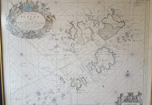
Scilly Isles Chart (1689)

Today’s topic is – once again – inspired by an experience on the Scilly Isles. It has to do with how things look different from one point of view than they do from another. If you were going to navigate between the islands – say from Bryher round to St Martin’s – then the chances are you’d pull out a map. If you were feeling particularly cautious, or you were going in a larger boat which drew more water, maybe you’d go up a grade and get yourself a chart with underwater depths plotted. Coupled with some knowledge of the tide, you could then plot out a course.

Now if you also had a GPS navigation system, in principle you could then hand over the course to that, sit back, and enjoy the journey with no more effort. But if you didn’t have that, and you were reliant on personally converting all that map work into movements of the tiller, you’d find that it is rather more tricky than it looks.

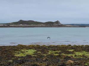
Samson, Tresco. S Mary's, and rocks between
Samson, Tresco. S Mary’s, and rocks between

A map is a top-down view of the world – the sort of thing you would see if you were flying. But out on the water you get a completely different perspective. You are looking along the (reasonably) flat surface of the water, seeing the sides of islands and rocks as they project up from that surface. Some things – perhaps your destination – are hidden behind other ones. Some things which look close together are actually far apart, having been brought together by visual accident. A passage between two rocks might appear wide and easy on your chart, but narrow and problematic on the water, since it calls for careful wiggling at key moments.

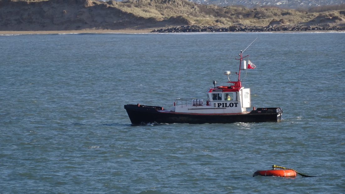
Now, of course, this was the norm for navigation throughout our history until very recently, and goes a long way to explaining why the profession of pilot was so important. The pilot knew his waters, and how to navigate ships of different sizes through them at different states of the tide – or indeed not to make the attempt until the tide turned.

Now, maps and charts to help navigation have been around for quite a long time – several centuries, at least. But a pilot in action was not so interested in the top down view given by a chart. What he wanted – needed – to know was the direction to steer in at any point. And this was done, by and large, by means of lines of sight. Certainly pilots necessarily built up a vast store of information of local conditions in all kinds of weather and tide. But the key to their navigation was the index of knowledge which knew that by lining up particular landmarks one behind the other, and trusting these remote guidelines over local phenomena, a difficult voyage could be broken down into a series of simple legs.

Swallows and Amazons cover (Goodreads)

Each sight line gives you a stage in your journey: each journey consists of a chain of such guidelines. Arthur Ransome used this idea in Swallows and Amazons, where a navigation line was set up by visible marks in daytime, or lanterns after dark. John says: “This [stump marked with white cross] is one of the marks, and the other is that tree with a fork in it… come into the harbour without bothering about the rocks by keeping those two in line”. In this way they could easily get in and put of the harbour on Wildcat Island. The pilot’s job was basically the same, but upscaled to a much larger region and a hugely more complex set of navigation tasks.

Solar eclipse March 2016 (NASA)

But it is not just navigation on the water which has this difficulty. When we look up at the night sky, at stars and planets, we are looking at objects scattered through a vast three-dimensional space, as though they were arranged on the surface of a sphere. Extremely distant objects are pressed together, and small nearby ones can hide much larger further-away ones – as in this solar eclipse. And although changing tides are not a problem in space, things are moving at different speeds, and if you are trying to navigate – say – from one of Jupiter’s moons down to Mars, you have to take into account the change of location which will happen in the meantime. Human pilots still ply their trade in many parts of the world, and although they are usually supported by electronic backup, it still calls for in-depth familiarity with their coast, and day-by-day assessments of change. I wonder if the same will be true if and when we move into space?

The Bideford pilot boat (http://www.boatstories.co.uk/the-bideford-pilot.html)

Recent news from the asteroid belt and beyond

Today’s blog collates various recent pieces of news about the asteroid belt and outer planets.

The series of spiral orbits used to move down to the low survey orbit - the new manouvre will more or less invert this, NASA/JPL
The series of spiral orbits used to move down to the low survey orbit – the new manouvre will more or less invert this, NASA/JPL

First, Ceres. The Dawn spacecraft has recently fired up its main ion drive again, in order to raise its orbit up to nearly 1500km. For the last few months it has been in orbit at 385km, closer to Ceres than the ISS is to us here on  Earth. This low orbit has been great for studying surface features, but there is plenty of science to be done from higher up, not least because the final orientation of the orbit in relation to Ceres and the sun will be quite different than on initial approach – this time it will go over the poles. The polar orbit is ideal for searching for additional water supplies to complement the ice already found (both on the surface and also below it). So the change was made while there is still enough fuel for the ion drive to make this transfer. A difficult choice had to be made between this, or the possibliity of moving on to a third asteroid – since Dawn has already over-delivered on the original objectives, either would have been a remarkable achievement.

Ahuna Mons in simulated perspective, vertical scale exaggerated by factor of 2, NASA/JPL

One of the last news releases before the orbit shift was about ice volcanoes, and in particular the volcano Ahuna Mons. It is an unusual shape, with other strange features, and the most plausible explanation at the moment is that it is basically a water volcano, spitting out water from a base of salty mud. Careful measurements of the orbital path have shown that the interior also contains a lot of water ice, probably arranged in a concentric shell around a rocky core. The asteroid – properly speaking a dwarf planet – is rather less dense than Earth or our Moon, but has an interesting internal structure which, perhaps, can one day be investigated more closely. At the same time, some traces of a very thin atmosphere were found – vastly too little to survive on, but enough to shape some surface conditions and interfere with the flow of the solar wind.

Inside Occator Crater, showing the bright pattern of salts (mostly sodium carbonate), NASA/JPL

Other studies from low orbit include the bright patches first noticed on the original approach. The brightest of all of these are in Occator Crater, and closer inspection has shown a large group of irregular refletive areas. The most prevalent theory is that they are patches of salt, exposed on the surface by geological activity from inide the planet as well as meteor impact from outside.

What we don’t know, of course, is how far these features are typical of asteroids more generally. Would, for example, prospective visitors to my fictional Scilly Isle asteroids find similar phenomena? At this stage, we don’t know. Dawn has visited just two asteroids – Ceres and Vesta. They were chosen in part because they are different from each other in various ways, not least the amount of water ice available (Vesta is much drier). It seems unlikely that these two snapshots have exhausted all the variety that there is to see.

Insofar as I have thought about the origins of the setting for these stories (and most of my thinking has been on much more immediate background) it seems likely that the hypothetical Scilly Isle asteroids would have common ancestry. After all, they’re only a matter of a few tens of thousands of km apart, and it would be a wild coincidence if they had all come from different places. In passing, this makes for a curious parallel with the real islands off the Cornish coast, since many of the islands we enjoy as separate places today were aggregated into a single island within fairly recent history. Bryher and Tresco were united as recently as the late 16th century, and in the Bronze Age only St Agnes was separate of the inhabited islands.

The presence of water ice in most of the solar system has become apparent over the last few years, and I have assumed that water supply would not be a problem for settlers. So far as Ceres goes, that’s certainly true. Our understanding of the particular details of how the ice is distributed will no doubt continue to evolve.

Haulani Crater in enhanced colour, highlighting newer material in blue, NASA/JPL

Much the same applies to mineral deposits of all kinds. Fictional asteroidal Scilly is full of failed attempts to mine substances. Today’s science community is rather divided as to whether asteroid mining will ever be financially viable. There is little doubt that all kinds of extractable material is present there, but serious questions remain as to whether the concentration or total volume is sufficient to meet the costs. In the books, Mitnash and his friends can make a decent return out of extracting rare earth elements from distributed areas of space with a higher proportion of dust and small rubble, variously called shoals and reefs in keeping with the oceanic turns of phrase throughout. We don’t yet know if this is feasible. As with so much else, we will have to wait for further exploration. Dawn has shown that a great deal can be done with automated probes, and it would be nice to imagine a long-term plan to map much larger sections of the asteroid belt.

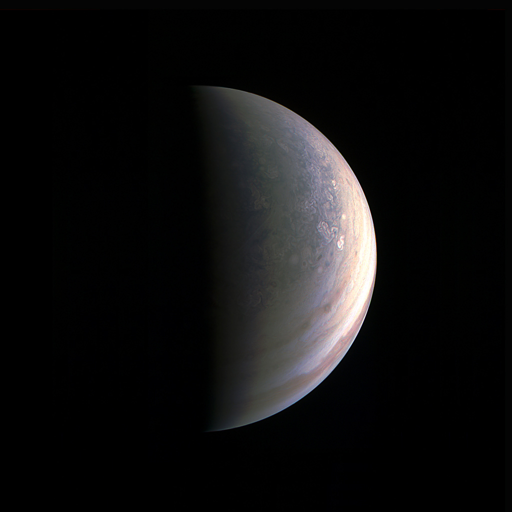
It’s appropriate to finish for today with a quick mention of Juno, orbiting Jupiter and starting to return impressive levels of information. Here’s a picture of Jupiter’s north pole, a sight impossible to see from Earth.

Jupiter's north polar region on August 27th, NASA/JPL
Jupiter’s north polar region on August 27th, NASA/JPL

Where do you bury the dead?

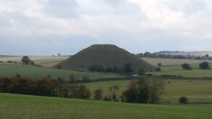
Silbury Hill, near Avebury

Throughout most of human history, we have made great efforts to commemorate the dead, particularly those who were important in some way, or whose actions deserved special honour. Conversely, we have shown disapproval by denying proper burial, or defacing graves and monuments. In ancient Egypt, a person’s name might be obliterated, with the intention of depriving them of both recognition and tangible offerings by future generations. But it is our treatment of the honoured dead which interests me today.

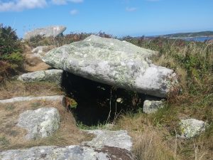
Entrance grave, Samson, Scilly

We have often buried a body, but we have also often buried the burned ashes of bodies, or items they used in life. In these cases, the tomb serves as a formal reminder of the person rather than an actual resting place. We have buried people singly, but more often in groups, according to family ties or the roles they fulfilled. And very often we have raised our memorials to the dead in prominent places, as an ongoing sign to the living.

Harold Wilson's grave, St Mary's, Scilly Isles
Harold Wilson’s grave, St Mary’s, Scilly Isles

Through most of history, until comparatively recently, we have liked to keep our dead close to us. Looking back in time, it is hard to know what the reasons for this were. Could it have been protection, to ensure that malevolent influences were kept at bay? Or to placate ancestors who might judge the living harshly? Or to provide comfort in a time of mourning? Or simply for convenience, to simplify the process of providing both prayerful respect and tangible offerings? Today, even though we are often geographically scattered from our ancestors, the sight of a grave that has been cared for and adorned with fresh flowers – or more personal items – usually touches and inspires us. Perhaps we see it as a vicarious offering on our own behalf, when we cannot do the same ourselves.

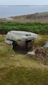
Innisidgen tomb, St Mary's, Scilly
Innisidgen tomb, St Mary’s, Scilly

On the Scilly Isles in the late Neolithic and Bronze Ages, the honoured dead were remembered with large stone cairns. They are now called entrance graves, and the style is largely unknown in most of Europe. A central area, roughly the size of a coffin, was lined with stones on either side. One end was chosen as the entrance, and blocked with a separate stone, often slightly offset so as to leave a gap. Finally, several large capstones were placed on top – this itself must have been a serious undertaking given the weight involved. There is a natural orientation to the graves – the line through the middle pointing in or out of the door – but there is no overall consistency about this orientation.

Few if any of them seem ever to have contained dead bodies, or even extensive grave goods, though ashes and oil have been found in some. Presumably the monument itself was sufficient to commemorate the people involved, even over several generations.

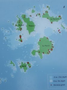
Entrance grave locations on Scilly
Entrance grave locations on Scilly – the shaded area shows the region uncovered in Neolithic times

On Scilly we find these monuments on the tops of hills, clustered together in lines and groups. That in itself is not very surprising, since it made them easily visible. But on Scilly, these hills are situated in a ring on the seaward edge of the land – the central lower-lying plain is now submerged under the encroaching Atlantic. This has happened within historical memory, and accounts from the Roman era through until the time of the Norman kings tell us of the gradual division into the archipelago we now see.

So this raises again the question of motive. Did the builders of these tombs expect that the honoured dead would protect them from invaders from over the sea? Perhaps even from the sea itself, since I am sure that the communities of the time would be aware that ancestral lands were, little by little, being eaten away. Or was the intention to face outwards, so that a person’s tomb remembered a great voyage they had made, or fishing areas that were especially generous?

Bant's Carn, looking down at Halangy village (and across at Tresco and St Martin's)
Bant’s Carn, looking down at Halangy village (and across at Tresco and St Martin’s)

At this remove in time, given that we are dealing with a culture that either could not or chose not to record itself in writing, we cannot answer these questions. They remain as enigmatic as the stones themselves. What we do know is that these places remained important to Scillonians for a very long time. One burial – Bant’s Carn, on St Mary’s, remained intact throughout the Bronze and Iron Ages, despite the presence of Halangy village which thrived just down the hill from it for many centuries. The villagers may have continued to hold ceremonies around the tomb, or may have placidly ignored it, but they lived in its shadow and took care not to demolish it. The desire to honour the dead runs very deep in us.

Writing, both historical and speculative