Category Archives: History

Identity, belonging, and taxes

Gladstone's budget briefcase (Wiki)
Gladstone’s budget briefcase (Wiki)

I’ve been meaning to write about this for some time now, but last week’s Budget here in the UK crystallised my thoughts. For non-UK readers, the Budget is a financial appraisal and forward plan presented by the Chancellor of the Exchequer. It’s an event where various changes to taxes are made, funding for different major projects is announced, and so on. It’s a chance for everyone to see what the Chancellor and his advisers think is going to happen, and how the country’s finances are going to be handled.

I’m not going to talk about the Budget itself – if you want, the whole document is available online. But there was one tiny snippet in the associated news which caught my eye:

Making tax digital – The start date for unincorporated businesses and landlords with turnover below the VAT registration threshold is deferred by one year to April 2019. Unincorporated business and landlord with turnover above the VAT registration threshold will be required to keep records in a digital format, and make quarterly reports of their results, from April 2018, using appropriate software.

In brief, it means that all firms, however small, will soon need to install suitable software, and be periodically linked up to the government tax computers to transfer earnings details. Those of us who are employed already get tax routinely withheld from our wages every payday, and the picture for the self-employed is rapidly converging.

UK Tax return (Wiki)

Seeing as how it is only a short time since the tax authorities dealt exclusively in annual paper documents, this shift to online quarterly assessment is a vast change. And it is probably only a staging post on the way towards daily accountability. It’s a huge step from days of yore, when if the local land owner – or his lord, or the king, or the conquering overlord – needed some revenue, he just sent his heavies around and took it.

We live in a world where increasing numbers of people expect to move internationally during their working life – perhaps as much as 1/3 or 1/2 of people entering employment now will make such a move before they retire. So daily accountability is a necessary step to make sure that the right amount of taxes are paid in the country where they are due… a highly charged matter which several multinationals have run foul of.

So all that collided in my thoughts with another modern trend. This second one has been called “filiation versus affiliation“. It describes a major shift which has happened from the ancient world until now. Back then, your birth family – filiation – counted for everything, even in adult life. Social mobility was extraordinarily hard. We are moving towards a situation where as an adult you choose your own affiliation – your friends, your employment, your peer group, your gang, or whatever. Different countries are at different places along that trend, but we are all slowly moving that way. I find it exciting that I can chat with, work with, and be friends with people across the world who I am never likely to meet… but there are problems and difficulties as well.

So all that made me think, what if you could choose your country – your national affiliation – as easily as joining a Facebook group? Maybe I like the education system in Sweden, the stance on nuclear weapons in New Zealand, and a whole collection of other policies scattered around the world’s nations. But geographically I like living here in the UK, and in particular have a number of tip-top favourite places.

A Carthaginian Shekel c. 300BC (Wiki)

So… what if I could shop around with my tax liability? I go off to work, earn a few shekels, spend some of them on the necessities of life… and owe some agreed fraction in taxes. What if I could then decide which nations I wanted to support with those taxes, and effectively buy fractional citizenship there? In much the same way as I dispose of the rest of my income – so much to the supermarket, so much to a local independent store, so much to Amazon, so much put aside for a rainy day, etc.

I don’t think this would be an easy transition to make – for example, how would I pay London Underground for the trips I make on the Northern Line? I’m quite sure my ticket price doesn’t cover the cost of capital investment and replacement. How would I pay for the running of the National Parks that I love? There’d be all kinds of difficulties to work through.

But on the other hand, this could be a logical direction for democracy. Right now, the world’s major democracies are struggling with how to manage situations of narrow majorities. Big policy changes are being made on both sides of the Atlantic which go against the wishes of almost half of a population. So why not consider not only voting in a ballot box, but voting with the results of our labour? A parliamentary or presidential democracy results – seemingly inevitably – in governments becoming increasingly hardened in their stance on issues, and the voices of minority groups become increasingly hard to hear. Maybe the ability to move our citizenship, or fractions of it, away from one country and into another would undo that.

Kickstarter Logo (www.kickstarter.com)

At very least it might make budgets more like a kind of kickstarter pitch. Last week, the overall majority enjoyed by the current British government meant that the Chancellor could pretty much do as he pleased. He didn’t have to win anyone over to his position – although in the days since his speech we have seen some backpedalling after interventions from the Prime Minister, so perhaps a bit more discussion beforehand would have been prudent. But what if I could listen to his ideas, decide if I liked them, and then decide if I wanted to support them by means of citizenship and taxes? I might take into account the present government’s track record on things I care about, or the present Chancellor’s level of experience and expertise. Maybe I’d be persuaded, or maybe I’d take my tax elsewhere to someone who convinced me better.

I think people have a capacity to take a long view, so this wouldn’t rule out big projects taking years to come to fruition. After all, we already do that with pensions, or funds set up in childhood for major events later in life. The biggest risk is, perhaps, that money, and those with it, would potentially overwhelm everything. But in many ways that’s already true – public funding has been successively cut back on a whole raft full of artistic, educational, and environmental causes over the last few years. Maybe a kickstarter style approach to national budgets would bring funding back to some of these.

The present system has winners and losers, and I dare say so will any new replacement one. But I wonder if overall such a system would be more equitable, or less?

Justice (Wiki)
Justice (Wiki)

Fun with the sun part 2 – the Analemma

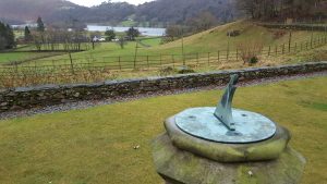
Sundial, Allan Bank, Grasmere, Cumbria

Part 2 of this little series looks at a different phenomenon to do with the sun’s movement through the sky. Imagine yourself picking a time of day – let’s say 10:30 in the morning – and taking note of where the sun is in the sky. Do this at the same time every day of the year to build up a curve tracing the sun’s apparent movement. One way to do this would be to take a photo pointing at exactly the same angle at exactly this time, then overlay the photos on top of each other. Another way would be to put a stick in the ground as a rudimentary sundial, then mark out the end of the stick’s shadow each day. It’s an easy experiment in principle, but takes a lot of patience and accuracy to get right.

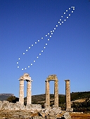
Analemma with the Temple of Zeus (340-330 BC) at Ancient Nemea, image credit Anthony Ayiomamitis, found at http://solar-center.stanford.edu/art/analemma.html

But suppose you’ve done that – what would you expect to see? We know that the sun goes up and down in the sky through the year – in winter it is lower and in summer higher. So i suspect that most people would expect to see a straight vertical line being plotted through the year as the sun cycles along its seasonal track. But actually what you get is not a straight line, but a figure eight shape. In the northern hemisphere the top loop of the 8 is smaller than the bottom, while in the southern hemisphere the loop nearer the horizon is the small one.

This curve is called the analemma, and has been known for a very long time – Greek and Latin authors wrote about it some two thousand years ago in the interest of designing a better sundial. My guess is that people observed this much longer ago, and that the creators of the great prehistoric stone observatory monuments tried to incorporate it in their designs.

We can describe this curve mathematically, and it is taught as a method of dead reckoning for those at sea. With a good watch to keep track of time, decent knowledge of the analemma shape, and some precise observations of the sun’s position in the sky, you can pinpoint your position down to around 100 nautical miles. Not bad if you’re lost at sea with no GPS!

The Earth's axial tilt (Wiki)
The Earth’s axial tilt (Wiki)

The root cause of this is a combination of two factors in the Earth’s movement. The first is that the polar axis, around which the Earth spins to give day and night, is not at right angles to the plane of the Earth’s orbit. This offset angle, a little over 23 degrees, is what gives us seasons. The second factor is that the Earth’s orbit around the sun is not perfectly circular, but a slightly squashed oval. Moreover the sun is not at the centre of the oval, but offset to one side at one of the two focal points – we are about 5 million km closer to the sun in early January than we are in early July. The Earth does not move at a constant speed around this oval. We speed up at closest approach to the sun, and then slow down as we move further away. Those who can remember school physics might have come across this as Kepler’s 1st and 2nd laws of planetary motion, originally formulated in the early 1600s.

A planet moves quicker when closer to the sun (http://scienceblogs.com/)

Now, for convenience we split our year into equal length days, which means that for one part of the year, a day according to our clocks gets ahead of its allotted portion of the orbit, and for another part it falls behind. By the end of the year it all comes out even. Also, the offset of the polar axis changes the degree to which these shifts make a real difference against the sky. The combination of these two factors is what generates the figure 8 shape of the analemma.

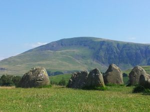
Castlerigg stone circle, Cumbria

Let’s think back to our ancient ancestors and the stone monuments they built. We know that the positions of the stones encode astronomical information. The monument builders were aware of not just the annual cycle of the sun, but also of more subtle patterns, such as the 28 year cycle that the moon makes in its own path against the sky. Since the analemma can be mapped out with nothing more complicated than a stick to make a shadow, it seems to me quite improbable that they did not know it. Having said that, I don’t know of any specific stone patterns that can be linked directly to the analemma. Once people started making sundials, they soon found that there was no single division of hour markers that works consistently. The figure 8 shape ensures that your sundial sometimes runs fast and sometimes slow.

Martian analemma, photographed by NASA's Opportunity rover, 2006-2008 (NASA/JPL)
Martian analemma, photographed by NASA’s Opportunity rover, 2006-2008 (NASA/JPL)

Moving into the future, every planet has its own variation of the analemma. The exact shape depends on interplay between the angle of the polar axis and the extent to which the orbit deviates from a pure circle. Our Earth has these two factors in approximate balance. So does Pluto, which therefore has a figure 8 shape like Earth, though in this case the top and bottom loops are almost the same size. But for other planets one factor or the other dominates. As a result, Jupiter has a simple oval shape, while Mars has a tear-drop. However, actually making the observations (as opposed to calculating them) might be tricky as you move out through the solar system. On Earth, you only have to wait 365 days. But a Jupiter year is almost 12 of our years, and Pluto takes nearly 250 years to circle the sun once. You would need extreme patience to plot out a full analemma cycle in both these places!

Golden Jubilee Sundial, Old Palace Yard, Westminster (Wiki)

Fun with the sun part one – the Equation of Time

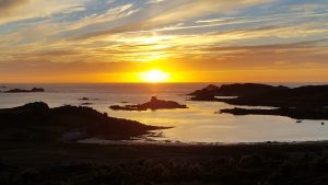
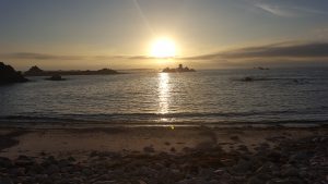
Sunset from Bryher
Sunset from Bryher

I guess pretty much all of us know that December 21st this year marked the winter solstice, and so – in the northern hemisphere – the shortest day and longest night of the year. But comparatively few people seem to know that this day is not the one when the sun rises latest and sets earliest. The exact dates of those events are, at the latitude of London, just over a week different from the solstice. Specifically, the latest sunrise this year is not until January 1st 2017, and the earliest sunset was on December 12th.

It turns out that the times when the sun rises and sets are governed by a moderately complicated algorithm called the Equation of Time. This obviously varies with your latitude and longitude, but also takes into account the small differences between the solar day and the sidereal day (the day length as measured against the distant and essentially fixed stars), seasonal variations in the earth’s distance from the sun, the apparent size of the solar disk, and a host of other relevant pieces of information. Strictly speaking, one’s height above sea level, and the details of the surrounding terrain also make a difference, but not in a way that’s easy to quantify here. Finally, there are several different definitions of what angle counts as the zenith line, and I have taken the civil definition as opposed to nautical or astronomical.

Once upon a time the calculations would have taken a very long time and lots of paper, but nowadays we can throw the calculation steps into Excel and find out the information for anywhere we want, and for a reasonably long span of time into the past or future. For the curious, a step by step description can be found at this link.

Sunrise through the year at different locations

Out of curiosity, I plotted the changes for a series of latitudes from that of Reykjavik in Iceland (just over 64 degrees north) via Orkney, Penrith and London in the UK, through Rome and the Tropic of Cancer to the Equator. For simplicity I just took everything on the zero longitude line (through Greenwich) since I was only interested in changes in latitude. If you wanted to do this for yourself then you would need to adjust for your actual longitude east or west from Greenwich, and your official time zone.

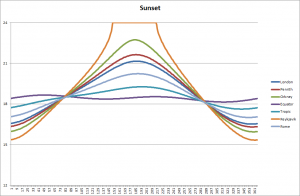
Sunset through the year at different locations

Here’s the corresponding chart for sunset.

A few things stand out at a quick glance. First, the time of sunrise varies considerably at some times of the year even between London and the north of Scotland. Secondly, you don’t have to go all that far north to get to the ‘land of the midnight sun‘. Thirdly, the total range of variation of sunrise is very small at the equator – about 1/2 an hour, as compared with London’s 4 1/2 hours, or Iceland’s 8 1/2 hours. The places where all these lines cross over is at the spring and autumn equinoxes, where night and day are each 12 hours long across the whole globe.

Sunrise - the early part of the year
Sunrise – the early part of the year

Going back to where we started, and looking carefully at the early part of the year, you can see that the day of latest sunrise happens after the solstice. The further north you go, the closer the two days are together. So in Reykjavik the latest sunrise is on December 26th. Come down to Orkney and it’s the 28th. In London you have to wait until January 1st. In Rome, January 5th. If you lived on the Tropic of Cancer (say in parts of the Sahara, roughly on a level with Kolkata, India) you’d be waiting for the 8th.

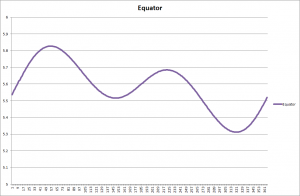
Changes through the year at the Equator

If you live right on the Equator something else comes into play. You get not just a simple days-get-longer then days-get-shorter cycle. Instead there is a more complex curve. Something similar happens in the whole belt of the tropics. This is because there are times when the sun at noon is to the south (as always happens in the northern hemisphere north of the Tropic of Cancer(, but then times when the noonday sun passes overhead and is, for a while, to the north. As it swings over and past you, the day length lengthens and then shortens again – as you can see in the graph.

OK, that’s enough of the Equation of Time for this week. Next time – another oddity about solar movements through the year, together with some thoughts about what this all means for us humans as we have observed the sun through the years. I am convinced that our remote ancestors knew about these patterns (though probably didn’t dress them up in the sines and cosines used by modern maths) and incorporated this knowledge into their monuments and observatories. But more of that next time…

Sunset from St Agnes

Celebrations

Christmas pudding and whisky

It’s a time of the year when we think about celebrations. Midwinter is an important time for several different religious reasons, but nowadays the main focus is on family and social events. To some extent, the spiritual roots of the festival as a time when new beginnings are stirring in the darkness of the year – at least, for those of us living in the northern hemisphere – have been overlaid with a focus on much more immediate pleasures. We meet as families, we eat and drink, we play games. In many workplaces the office party provides an arena in which normal hierarchies can be set aside for a while.

Yi Peng Lantern Festival, Thailand (Photo by Justin Ng)

My guess is that even at times when religious observance was more common than now, these more visceral elements were still an important part of the winter festival. Human beings may be rational animals (the saying goes back to Aristotle, some 350 years BC) but we are also playing animals, and fun-loving animals. Go back through the sacred calendars of the world’s religions, and you will find plenty of opportunities to celebrate as well as be solemn. Hardship and deprivation hardly ever erase the human desire to make meaning by way of groupish events.

Of course, the very same things which make an event good for one person might be difficult or painful for another. The celebrations that a group of people chooses can serve to reinforce difference, rather than undo such barriers. We may be good at finding causes to celebrate, but we’re also good at finding ways to include and exclude others from our celebrations. It would be nice to think that opportunities for inclusion might outweigh exclusion as we move forwards.

I see the act of celebration as one of the great unifying threads holding humanity together, whether you look back into the remote past or forward into the distant future. Whichever of these I am writing about, there will always be group events! However challenging the times, however alien the setting, it’s hard to imagine a society which has no provision for communal events.

The M31 Andromeda Galaxy, the most distant object easily visible to the naked eye, NASA/JPL

Guest blog at Dawlish Chronicles – South-West England’s Gigs

This is a guest blog I wrote for Antoine Vanner’s Dawlish Chronicles – follow the link for the original in context. The part at the end where I talk about Dawlish refers to Antoine’s protagonist, Nicholas Dawlish, who is a Royal Naval officer in the latter part of the 19th century. I have reviewed several of his books before, and am looking forward to reading the latest, Britannia’s Amazon, available now in paperback and shortly in Kindle.

Antoine has kindly given me space today to talk about gigs and their use in south-west England, specifically the Scilly Isles and Cornwall. So far as I am aware these have never been used in war, but their history is no less exciting or varied for that.

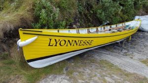
Gig Lyonnesse on St Agnes

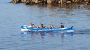
First, what is a gig in this context? Picture something that looks roughly like a clinker-built rowing eight. Keel to gunwale depth is around two feet, and once crewed, the waterline is almost exactly at the mid-point. At 32′ long, just under 5′ beam, but with elm planks only 1/4″ thick, the boat is light enough that the crew can pick her up and carry her into the water. Many years of experience mean that a gig has been built robustly enough to take on the Atlantic swell, despite the apparent flimsiness.

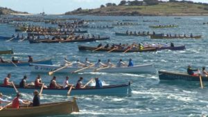
Like an eight, each oarsman has a single oar, and they sit to row alternately port and starboard facing the cox’n. But curiously, they have only six rowers, reflecting part of their history. A mast and lugsail could be fitted if desired, though in commercial practice this was rarely done. They are fast, tough little boats, and at one stage played a crucial role in the economic livelihood of the islands. Today they have retired from commercial use, but have found a new lease of life in competitive sport. The annual world gig racing championship is held on Scilly every April/May. In 2016 it attracted more than 150 boats from many different countries.

Some of the 3000+ rowers in the 2016 races (ITV West Country)

We can trace the history of the gig back to 1666 at least, when vessels from St Mary’s were involved in rescuing the crew of the Royal Oak, wrecked out at what is now the Bishop Rock lighthouse. We have no reason to suppose there were not earlier vessels of essentially the same pattern. All modern gigs are based on the lines of an early 19th century design by William Peters. They had two principal uses, the main one being to get local pilots out to incoming ships as quickly as possible. Whoever got there first got the contract, hence the need for speed. Scilly was one of the major landmarks for vessels inbound from the western trade routes, but the seas are treacherous here, with countless rocks and reefs. Even with modern navigation aids they are hazardous: how much more so in former days? So families or village groups would aim to spot new arrivals as early as possible, and get out to them as quickly as possible.
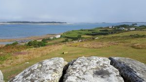
The St Agnes gig, Shah

The other use, more humanitarian than commercial, was as a kind of early lifeboat system. Gig crews over the years have saved a great many lives by going out – frequently in horrendous weather – to rescue crews and passengers suffering shipwreck. Cargo could also be brought back, and an 1887 rescue of 450 cattle from the Castleford involved lashing the animals’ heads and horns to the sides of the gigs Gipsy and O&M, and towing them to a handy nearby island! Such rescues were fearfully dangerous acts, and the churches on Bryher, St Agnes and elsewhere remember many who never returned.

Now, gigs came to the attention of the revenue authorities, who suspected that they had a third use – for smuggling. Certainly they would have been capable of it, with their proven seagoing capability. Even the Cornish coast was within a day from the Scilly Isles for a good crew – the 40-odd mile trip to Penzance typically takes under 10 hours, and Newquay was within comfortable reach. Gigs could easily make the 250-mile round trip to France’s Breton coast by staying out at sea for a day or so, and were robust enough to cope. Bonnet (of which more later) rode out a thirty-hour storm on one such trip by keeping head to wind until conditions improved. A good crew can sustain speeds of around 7 knots, but speeds of nearly 10 knots have been recorded over a measured mile with racing crews rowing at 40 strokes per minute. But therein lay a problem – an eight-oared gig was faster than the customs cutters of the time. This was clearly unacceptable, so a law was passed in 1829 limiting the crew to no more than six oars per boat.

Time passed, and both piloting and rescue ceased to be the responsibility of the islanders. The last recorded pilotage was in December 1938, when the Bryher boat Gipsy went out from St Agnes. As for rescue, the last known one was of the Panamanian steamship Mando in 1955. For a time, it seemed possible that gigs in the traditional sense would die out. Some of the older craft were laid up in storage, others suffered the usual fate of wooden boats which are not constantly cared for.

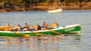
Bonnet pulling ahead of Golden Eagle

Then competitive racing emerged, giving a new lease of life to the design. Informal races had been part of gig culture for a long time: now it has become organised. Inter-island men’s, women’s and mixed races take place weekly during the tourist season, quite apart from the challengers coming from further afield. And here, the robust nature of the vessels is once again proved. Bonnet still races today – she was built in 1830 and had a long and busy working life. She is heavier than her modern siblings, but if there’s a bit of a sea this might not be a disadvantage. Back in August, I saw her beat a dozen other boats to win her race. The Cornish gig Newquay was built back in 1812, and is claimed to be the oldest ship afloat which is still being used for broadly the same purpose as when she was made. Appropriately, she is owned by the Newquay Rowing Club, who also look after Dove (1820) and Treffry (1838) – all still racing.

So, this brings us to Antoine’s own protagonist, the naval officer Nicholas Dawlish, and the timeline set out for his life. Bonnet had been working for 15 years when Dawlish was born in December 1845, and for over fifty years at the time of Britannia’s Spartan. There’s a fair chance that Newquay was built before Dawlish’s father was born. On the assumption that Dawlish passed the Scillies at some stage during early career – and it would be wildly improbable if he had not had cause to see them at close quarters – he would have seen gigs in active commercial use. I wonder, with his eye for design, if he took the time to appreciate their blend of speed, strength and elegance?
Finally, for those who want to look at videos, this video has the 2016 men’s final and lots of links to other clips:


When the earth moves under your feet

Today’s blog was written as a guest post at The Review.

In Britain, we’re used to history – and historical fiction books – where the terrain is basically the same as today. The human presence on the surface might well change, so that towns and cities grow, old buildings turn to ruins, rough tracks turn into railway lines, and so on. Or we might alter the clothing of vegetation – marshes are drained, forests felled, or fertile land turns to peaty bog. But we generally feel here in England that the bones of the landscape itself remain the same on a human timescale. We expect the land to change form only over geological timescales.

Mt St Helens before and after (USGS images)

Other people though, in other parts of the world, have a different expectation. Earthquakes, volcanoes and tsunamis can not only cause loss of life or damage to property, but can reshape the terrain. Mount St Helens was reckoned to be one of the most attractive of the Pacific Rim volcanic cones until May 18th 1980, when the eruption removed over 1/8 of the volume of the former cone. Iceland gained a new island in November 1963, when Surtsey emerged from the waves as a result of subterranean action.

But often we Brits think of that as something which happens in other lands. But actually there are signs of change in counties like Norfolk and Lincolnshire. Near to Cromer, several villages named in the Domesday Book or other more recent records are now up to half a kilometre out to sea. There is evidence that the Lincolnshire coast was, until the 13th century, protected by a chain of offshore barrier islands. The demise of these in a series of storm surges drastically altered the coastline and its vulnerability to the sea. But despite these signs here in our own land that our not-so-distant ancestors walked across a different landscape, it takes a bit of adjustment.

The geology is quite straightforward. During the last ice age, a little over 10,000 years ago, a hugely heavy layer of ice pressed the land downwards, to a greater degree in the colder north than the warmer south. When the ice melted, two things happened. The sea level rose because of extra water. But also the land shifted. The land in places where the ice had been heaviest started to lift up. Outside that, further south, it started to sink down. Try placing a heavy book on a soft cushion and you’ll see the effect in action.

Now, 8000 BC is not all that long ago, really – the Neolithic Age, and so the beginnings of recognisably complex society started not all that much later, around 5000 BC. And although the vertical movement of land in any one year is tiny – perhaps a few millimetres – over the course of a century it adds up. Our Neolithic and Bronze Age ancestors in some parts of the country experienced quite different terrain.

Aerial view of the Scilly Isles (Wiki)

In the north, where the land has lifted, we find settlements which used to be on the coast now stranded well above the waterline. Stone circles at the southern end of Coniston Water, in Cumbria, used to be close to an arm of the sea reaching in from Morecambe Bay, but are now over five miles from the coast.

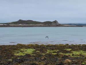
But in the far south, in the Scilly Isles, we see an even more dramatic change as the land sinks down. During the Bronze Age, when many of the prehistoric monuments were being built, there was basically a single large island. Around that, especially to the west, there were a few scattered outposts including what we now call St Agnes, Annet, and the Western Isles. The whole central area, now a submerged area in which quite large vessels can anchor if they find the deep patches, was then a fertile plain supporting crops and animals.

Tidally submerged field wall, Samson, Scilly Isles

All that has gone – perhaps spawning tales of Lyonesse or Atlantis – but its passing has been recorded in history. Even now, low tide allows careful explorers to go well beyond the shoreline, disturbing herons and other wading birds browsing what has been left in the seaweed and rock pools. You pass by the remains of stone walls which presumably served as boundary markers, but are now submerged much of the time. At especially low spring and autumn tides, tall people can still cross between most of the islands without swimming – so long as you know where the sand bars and shallow patches are.

As well as simply projecting backwards the change in sea level, at a rate of 30 centimetres per century, we can look back at history. We know that in 1127, Tresco and Bryher were still a single island, with the two names referring simply to internal parish divisions. By 1600 they were separate, and the Grimsby Sound between them had become a sheltered haven for ships. The transition did not take many generations, and you have to wonder what the occupants made of the stories of their ancestors.The central area between St Mary’s and the northern cluster of islands probably flooded around 6-700AD. On the other side of the country, ship burials were happening at Sutton Hoo.

But a change of 30 centimetres per century disguises the more dramatic way in which these events unfolded. This figure comes into perspective when you remember that the tidal range in a big spring tide on Scilly is around six metres. During a winter storm, waves coming across the Atlantic sometimes break over the top of the Bishop Rock lighthouse, some fifty metres high. The changes to separate island from island have not always been the result of a steady trickle of rising water; some will have been dramatic, cataclysmic events.

Samson, Scilly Isles - still one island at present...
Samson, Scilly Isles – still one island at present…

This continues to happen today. It used to be reckoned that there were 146 islands in the archipelago, where an island is defined as a body of land separated at high tide and able to support vegetation of some kind. A few winters ago, this became 147, when a severe storm broke through a thin land bridge at Rushy Bay, Bryher, and converted a peninsula into an island. You look at some places as you walk around, and wonder how long they will remain attached.

From a fictional point of view, these kinds of gradual changes to the land itself offer a new storytelling dimension. Authors have explored – and I hope will continue to explore – sudden changes like the eruption of Vesuvius, or various earthquakes. Gradual change has not, I think, been used nearly so often. It could perhaps make for an interesting historical plot based on prehistoric Doggerland, in today’s North Sea. Or a speculative fiction story where diminishing land serves as a variation on resource failure. It’s worth remembering that the terrain we see today is not eternally fixed – even in this green and pleasant land – and has its own changing history.

A Matter of Perspective

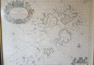
Scilly Isles Chart (1689)

Today’s topic is – once again – inspired by an experience on the Scilly Isles. It has to do with how things look different from one point of view than they do from another. If you were going to navigate between the islands – say from Bryher round to St Martin’s – then the chances are you’d pull out a map. If you were feeling particularly cautious, or you were going in a larger boat which drew more water, maybe you’d go up a grade and get yourself a chart with underwater depths plotted. Coupled with some knowledge of the tide, you could then plot out a course.

Now if you also had a GPS navigation system, in principle you could then hand over the course to that, sit back, and enjoy the journey with no more effort. But if you didn’t have that, and you were reliant on personally converting all that map work into movements of the tiller, you’d find that it is rather more tricky than it looks.

Samson, Tresco. S Mary's, and rocks between
Samson, Tresco. S Mary’s, and rocks between

A map is a top-down view of the world – the sort of thing you would see if you were flying. But out on the water you get a completely different perspective. You are looking along the (reasonably) flat surface of the water, seeing the sides of islands and rocks as they project up from that surface. Some things – perhaps your destination – are hidden behind other ones. Some things which look close together are actually far apart, having been brought together by visual accident. A passage between two rocks might appear wide and easy on your chart, but narrow and problematic on the water, since it calls for careful wiggling at key moments.

Now, of course, this was the norm for navigation throughout our history until very recently, and goes a long way to explaining why the profession of pilot was so important. The pilot knew his waters, and how to navigate ships of different sizes through them at different states of the tide – or indeed not to make the attempt until the tide turned.

Now, maps and charts to help navigation have been around for quite a long time – several centuries, at least. But a pilot in action was not so interested in the top down view given by a chart. What he wanted – needed – to know was the direction to steer in at any point. And this was done, by and large, by means of lines of sight. Certainly pilots necessarily built up a vast store of information of local conditions in all kinds of weather and tide. But the key to their navigation was the index of knowledge which knew that by lining up particular landmarks one behind the other, and trusting these remote guidelines over local phenomena, a difficult voyage could be broken down into a series of simple legs.

Swallows and Amazons cover (Goodreads)

Each sight line gives you a stage in your journey: each journey consists of a chain of such guidelines. Arthur Ransome used this idea in Swallows and Amazons, where a navigation line was set up by visible marks in daytime, or lanterns after dark. John says: “This [stump marked with white cross] is one of the marks, and the other is that tree with a fork in it… come into the harbour without bothering about the rocks by keeping those two in line”. In this way they could easily get in and put of the harbour on Wildcat Island. The pilot’s job was basically the same, but upscaled to a much larger region and a hugely more complex set of navigation tasks.

Solar eclipse March 2016 (NASA)

But it is not just navigation on the water which has this difficulty. When we look up at the night sky, at stars and planets, we are looking at objects scattered through a vast three-dimensional space, as though they were arranged on the surface of a sphere. Extremely distant objects are pressed together, and small nearby ones can hide much larger further-away ones – as in this solar eclipse. And although changing tides are not a problem in space, things are moving at different speeds, and if you are trying to navigate – say – from one of Jupiter’s moons down to Mars, you have to take into account the change of location which will happen in the meantime. Human pilots still ply their trade in many parts of the world, and although they are usually supported by electronic backup, it still calls for in-depth familiarity with their coast, and day-by-day assessments of change. I wonder if the same will be true if and when we move into space?

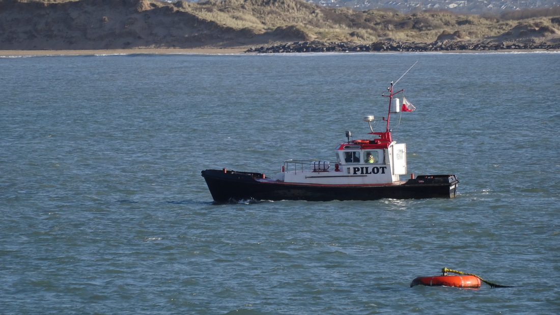
The Bideford pilot boat (http://www.boatstories.co.uk/the-bideford-pilot.html)

Where do you bury the dead?

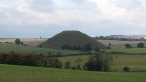
Silbury Hill, near Avebury

Throughout most of human history, we have made great efforts to commemorate the dead, particularly those who were important in some way, or whose actions deserved special honour. Conversely, we have shown disapproval by denying proper burial, or defacing graves and monuments. In ancient Egypt, a person’s name might be obliterated, with the intention of depriving them of both recognition and tangible offerings by future generations. But it is our treatment of the honoured dead which interests me today.

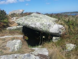
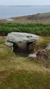
Entrance grave, Samson, Scilly

We have often buried a body, but we have also often buried the burned ashes of bodies, or items they used in life. In these cases, the tomb serves as a formal reminder of the person rather than an actual resting place. We have buried people singly, but more often in groups, according to family ties or the roles they fulfilled. And very often we have raised our memorials to the dead in prominent places, as an ongoing sign to the living.

Harold Wilson's grave, St Mary's, Scilly Isles
Harold Wilson’s grave, St Mary’s, Scilly Isles

Through most of history, until comparatively recently, we have liked to keep our dead close to us. Looking back in time, it is hard to know what the reasons for this were. Could it have been protection, to ensure that malevolent influences were kept at bay? Or to placate ancestors who might judge the living harshly? Or to provide comfort in a time of mourning? Or simply for convenience, to simplify the process of providing both prayerful respect and tangible offerings? Today, even though we are often geographically scattered from our ancestors, the sight of a grave that has been cared for and adorned with fresh flowers – or more personal items – usually touches and inspires us. Perhaps we see it as a vicarious offering on our own behalf, when we cannot do the same ourselves.

Innisidgen tomb, St Mary's, Scilly
Innisidgen tomb, St Mary’s, Scilly

On the Scilly Isles in the late Neolithic and Bronze Ages, the honoured dead were remembered with large stone cairns. They are now called entrance graves, and the style is largely unknown in most of Europe. A central area, roughly the size of a coffin, was lined with stones on either side. One end was chosen as the entrance, and blocked with a separate stone, often slightly offset so as to leave a gap. Finally, several large capstones were placed on top – this itself must have been a serious undertaking given the weight involved. There is a natural orientation to the graves – the line through the middle pointing in or out of the door – but there is no overall consistency about this orientation.

Few if any of them seem ever to have contained dead bodies, or even extensive grave goods, though ashes and oil have been found in some. Presumably the monument itself was sufficient to commemorate the people involved, even over several generations.

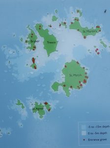
Entrance grave locations on Scilly
Entrance grave locations on Scilly – the shaded area shows the region uncovered in Neolithic times

On Scilly we find these monuments on the tops of hills, clustered together in lines and groups. That in itself is not very surprising, since it made them easily visible. But on Scilly, these hills are situated in a ring on the seaward edge of the land – the central lower-lying plain is now submerged under the encroaching Atlantic. This has happened within historical memory, and accounts from the Roman era through until the time of the Norman kings tell us of the gradual division into the archipelago we now see.

So this raises again the question of motive. Did the builders of these tombs expect that the honoured dead would protect them from invaders from over the sea? Perhaps even from the sea itself, since I am sure that the communities of the time would be aware that ancestral lands were, little by little, being eaten away. Or was the intention to face outwards, so that a person’s tomb remembered a great voyage they had made, or fishing areas that were especially generous?

Bant's Carn, looking down at Halangy village (and across at Tresco and St Martin's)
Bant’s Carn, looking down at Halangy village (and across at Tresco and St Martin’s)

At this remove in time, given that we are dealing with a culture that either could not or chose not to record itself in writing, we cannot answer these questions. They remain as enigmatic as the stones themselves. What we do know is that these places remained important to Scillonians for a very long time. One burial – Bant’s Carn, on St Mary’s, remained intact throughout the Bronze and Iron Ages, despite the presence of Halangy village which thrived just down the hill from it for many centuries. The villagers may have continued to hold ceremonies around the tomb, or may have placidly ignored it, but they lived in its shadow and took care not to demolish it. The desire to honour the dead runs very deep in us.

Buttermere, Rannerdale and the Norman Conquest

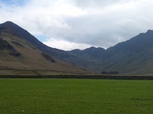
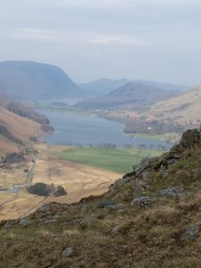
There’s a lot of interest in the Norman Conquest just now, what with the 950th anniversary of the Battle of Hastings approaching. So I thought I’d post about a loosely related event up in the Lake District, in the adjoining valleys of Buttermere and Rannerdale. Today’s Buttermere is a quiet and peaceful spot, with only a small scattering of houses set along the valley. Rannerdale itself is entirely unpopulated.

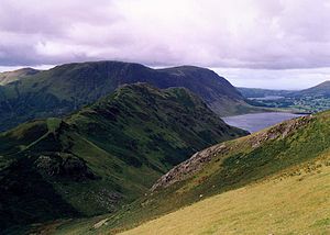
Buttermere and Crummock Water from below Fleetwith Pike

Back in the 11th and 12th centuries, however, they are said to have been a centre of Cumbrian resistance to the Norman invaders. Northern England tried to prevent assimilation into Norman rule, and suffered very considerably by way of reprisals. Cumbria was at this time considered part of Scotland – this lasted until the mid 1200s – and its population derived heavily from Viking stock. It seems that there was no appetite for submitting to William the Conqueror or his representatives here.

So – allegedly – resistance focused around a man called Jarl Buthar, who established for himself a secure defensive position (some say that the name Buttermere is a corruption of Buthar’s Mere). It’s a good place to defend – if you don’t know the area, or you’re trying to move in with a substantial body of troops, there are not many options. You can come round the outside of the Cumbrian fells, requiring a long march and exposing your supply chain to endless harassment. Or you can try coming over what we now call the Honister Pass, a difficult and rugged journey which again leaves you at the mercy of those who know the land better. The side walls of the valley containing Buttermere and Crummock Water are out of the question.

From Buttermere towards Haystacks

So there Buthar dug himself in and conducted a guerilla war for the better part of 50 years. The Domesday Book of 1086 says nothing about the area, and we have to presume that it remained at liberty. Norman nobles tried several times to break in, but the region was only secured and subdued in the 12th century

Rannerdale from Whiteless Breast with Crummock Water beyond

Which brings us to Rannerdale (Ragnar’s Dale). As I mentioned, today it is a quiet offshoot from the main valley, nestling under the slopes of Whiteless Pike and Grasmoor. It is best known for a spectacular crop of bluebells, which unusually grow out in the open here rather than in woodland. But according to rumour it was the place where Buthar lured a group of Normans led by Ranulph les Meschines and then slaughtered them in an ambush. The bluebells originated from the blood of the fallen.

How much of the tale is truth and how much legend? It has to be said that archaeologists are sceptical of the account, largely through lack of supporting evidence, and a common idea is that it is a romanticised version of the last stand of the Cumbrians against the unstoppable Normans. Be that as it may, it has triggered at least two work of fiction – The Secret Valley: The Real Romance of Unconquered Lakeland, by Nicholas Size in 1930, and Shield Ring, by Rosemary Sutcliff in 1956.

When you have finished exploring it, there are the more sedentary delights of Buttermere Village, including Syke Farm with its splendid icecream and other menu items…


Reusing sacred places

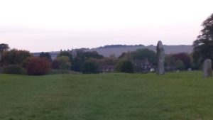
Avebury evening
Avebury evening

Today is another look at prehistoric monuments in England, and in particular the way sites were reused and reinterpreted by later generations. My main focus is going to be religious or sacred use – obviously some houses and forts stay in use for many hundreds of years, but this doesn’t usually involve much change of purpose.

The modern stereotype is that later religious groups are implacably hostile towards earlier ones, violently trying to erase all signs that things were ever different. Certainly this happens from time to time – the attempted destruction of Palmyra is a glaring recent example – but actually, quiet assimilation of a site is very common.

Let’s look first at Stonehenge. Before the raising of the giant stones which are most people’s association with the site, there was a true henge there. The earliest part of the whole structure is a circular bank with an entrance facing compass point. There was also a ring of wooden posts, including a series set at intervals across the entrance, and a few outlying marker stones picking out specific angles from the centre.

Stonehenge building stages (from http://www.faculty.virginia.edu/)

Now, like most henges of its era, it was built around lunar alignments. The centre of the entrance, the postholes across it, items buried at particular places in the ring – even the main outlying stone called the Heel Stone – all of these pick out significant events in the lunar cycle. Now, since a full cycle takes 18.6 years, and it would take a few such cycles to be sure of the observations given inconveniences such as clouds, this already represents a huge summary of embodied knowledge. But let’s move on.

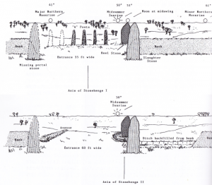
Time passed, as did the original builders, and the site was reused by new people with new beliefs. They didn’t just put up new stuff – like the stones – they repurposed the whole place. The entrance was widened, but asymmetrically, so that the midpoint was now angled to accommodate a solar orientation. You have to wonder if the newcomers were aware of the previous lunar settings and making deliberate changes, or if they just thought the earlier inhabitants had built it wrong. Even in very recent years, we’ve certainly not understood the builders’ purpose.

Stonehenge I and II (Burl, from Prehistoric Astronomy and Ritual)

Whatever the level of knowledge and the motives of the new users, the end result was to rebrand Stonehenge as a solar monument. The great majority of visitors since then have seen only this more recent, more obvious configuration, and the rediscovery of the older focus on the moon has been slow to emerge.

We know nothing about the transition from lunar to solar beliefs. Was it a peaceful and gradual shift, or a sudden and more violent one? Did the circle remain in regular use throughout, or was it abandoned for a while? It seems to me that the fact that the same site was reused, whether after a gap or not, must say something. It would be all too easy for the new solar-oriented worshippers to simply ignore the very obvious bank of earth and wooden posts, and erect their own monument nearby. Yet they chose to carry on in the same place.

Knowlton church inside the henge (English Heritage)

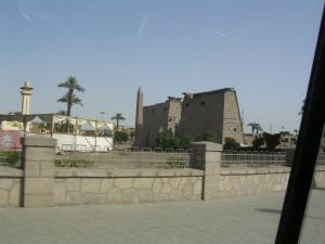
Such reuse of an older sacred place by later generations is very common. Many springs and pools held sacred to the traditional religions of the British Isles were adopted by the Romans, Saxons and Normans, often ending up linked with Christian saints and having churches built there. Knowlton church, in Dorset, was situated within the ring of a much older henge, and most of Avebury village is inside the huge extent of the monuments there. In Karnak, part of the Pharaonic temple was used as a Christian church, and subsequently a mosque.

Karnak Temple showing church and then mosque

What motivates this reuse? Does it represent a kind of spiritual conquest, in which the new element needs to purify the old? Or is it a way to legitimise the new by means of linking it with a place long held to be sacred? Is it simply that people are already used to going there, and this is a way to set up your pitch where there are already crowds of worshippers? Or is it that some places on earth really do have a heavier weight of sacredness than others, and some sensitivity to this motivates the builders of places of worship?

For the monuments I am thinking of, we will never have historical records which might explain the motives. All we have are enigmatic questions, and the clear signs that religious sites changed their focus over the generations as the original purpose became less important.

Looking forward in time, I wonder what might happen if we encounter signs that alien races have built sacred monuments elsewhere in our solar system or further afield? Will we set up our own shrines among the stones and stellar alignments, and in doing so continue our millennia-old habit of reuse? Right now we have no clear signs of extraterrestrial life of any kind at all, still less life that is sophisticated enough to reflect on the universe and build artefacts in holy places. One day, perhaps.

Saturn's rings, with Enceladus and Tethys aligned (NASA/JPL)
Saturn’s rings, with Enceladus and Tethys aligned (NASA/JPL)