I’ve been a sucker for maps for as long as I can remember, and as a child took great pleasure in following some story – usually fictional, but sometimes real-world – across a map representation. And where, as in the Narnia series, there was a series of maps that didn’t easily line up with each other, there was even more fun to be had in trying to trace them, then rescale and reposition the separate pieces to try to get to the whole thing.
Now until fairly recently, the idea of having a map of Pluto or its primary moon Charon was completely out of the question – if you wanted to write a story set out there, you could pretty much draw your own map. It would be almost impossible for anybody to refute your suppositions. In fact, very few people set stories there, except as some incidental waypoint en route to somewhere else, or as a location to meet some alien creature. It was broadly regarded as not only inhospitable, but also likely to be profoundly boring.

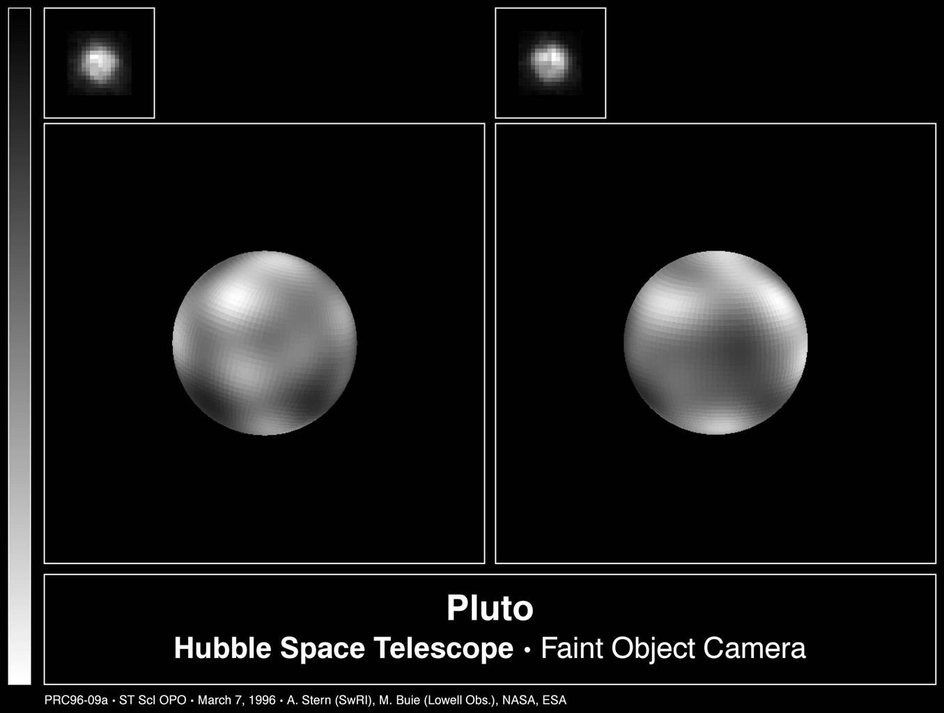
All that changed when the New Horizons probe flew past Pluto and Charon in July 2015. Blurry pixellated images turned into extraordinary high-resolution ones. Surface features became visible, showing a huge and unexpected diversity of terrain. Pluto was no longer a dull and boring place, but one of the most exciting and rich places to investigate. The New Horizons cameras did not just pick up surface features, but clouds and atmospheric haze. Pluto is still – of course – a very cold place to live, but this fly-by convinced the scientific community that it is an interesting one.
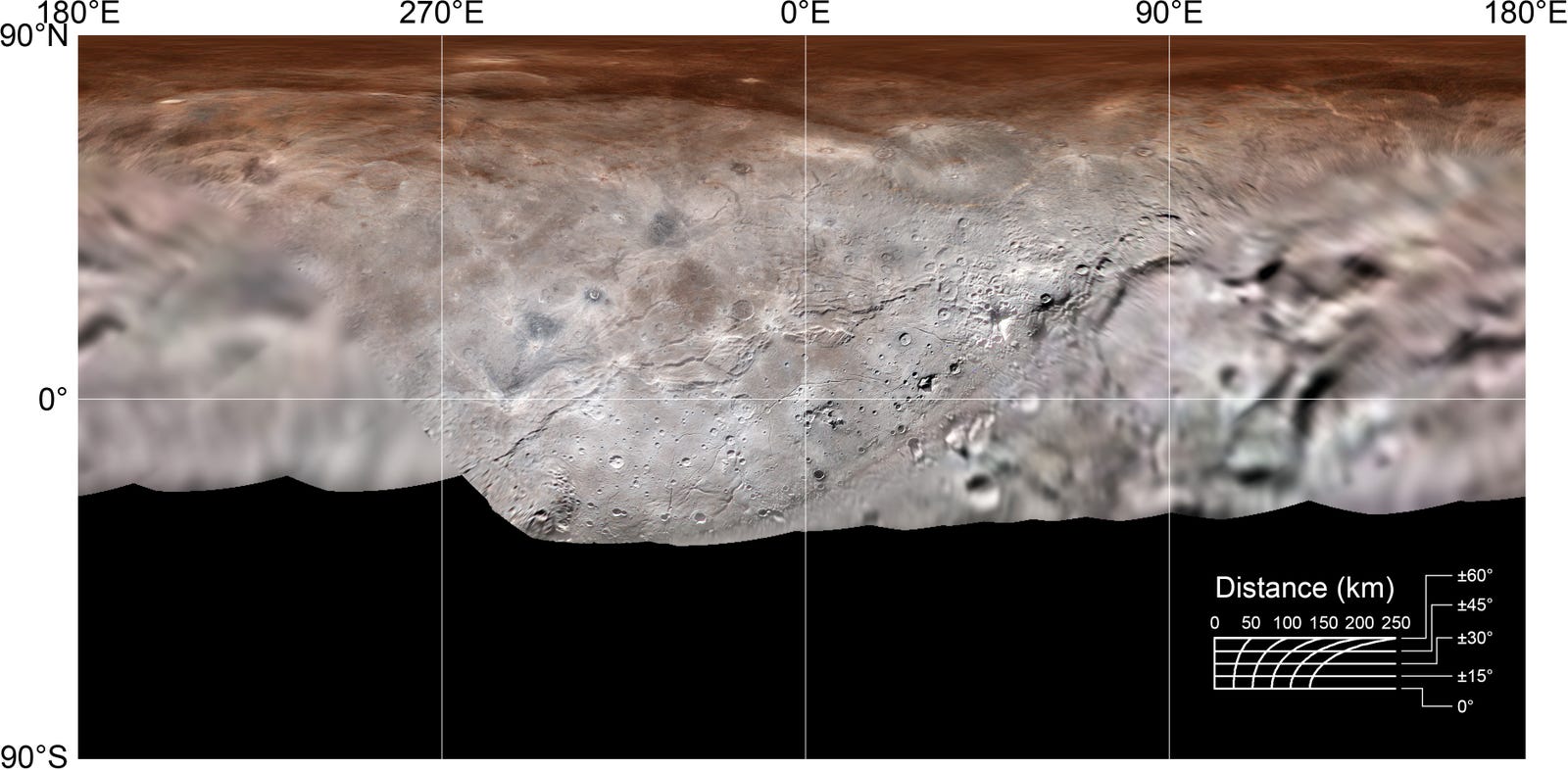
Now, my own interest is more focused on Charon than Pluto – for a variety of reasons my current work-in-progress, The Liminal Zone, is set on Charon. This means that the occupants of the habitat there can look out and up at Pluto whenever they choose – the apparent diameter is rather larger than that of the Earth as seen from our Moon. Charon has deep troughs that plunge 14 km below the mean surface level (deeper that Earth’s Marianas Trench), and mountains that extend some 8 km above it. Here is the raw map of Charon’s surface…
And here is a less detailed, but annotated version…
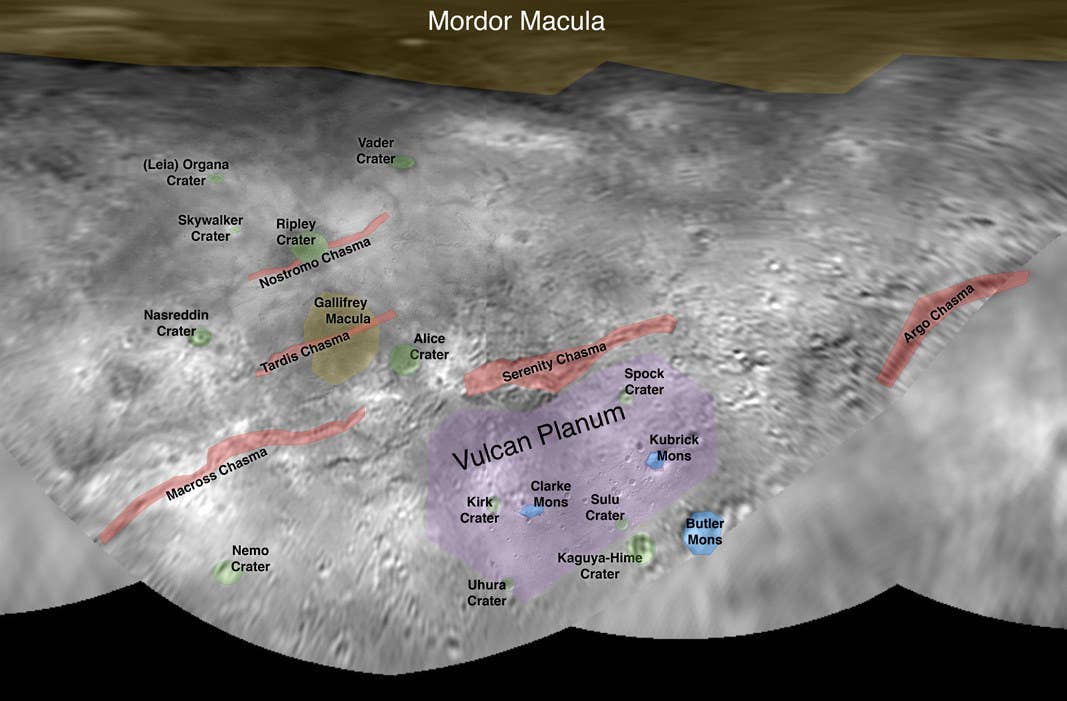
In The Liminal Zone, the habitat area is on the border between Vulcan Planum and Serenity Chasma. The former is reasonably flat, the latter is very rugged. To find out more, you’ll have to wait just a little longer…