A few days ago I finally achieved a long-standing goal of walking north from Boot (in Eskdale, Cumbria) up towards Wastwater. Boot is quite remote, to say the least. The shortest route from Grasmere, by a considerable margin, is over the Wrynose and Hardknott passes, but these are difficult in a lot of weather conditions, so some folk take the longer route around southern Cumbria via Ulverston and Broughton-in-Furness. Happily the weather smiled on my journey, so the passes needed only ordinary care – and I’ll be writing a bit more about Hardknott on another occasion. Wastwater has a reputation of being the most remote lake in all of Lakeland, but since it has a fairly direct route up onto Scafell or Scafell Pike (depending which track you choose at the start, down in the valley) it still attracts a decent number of people.
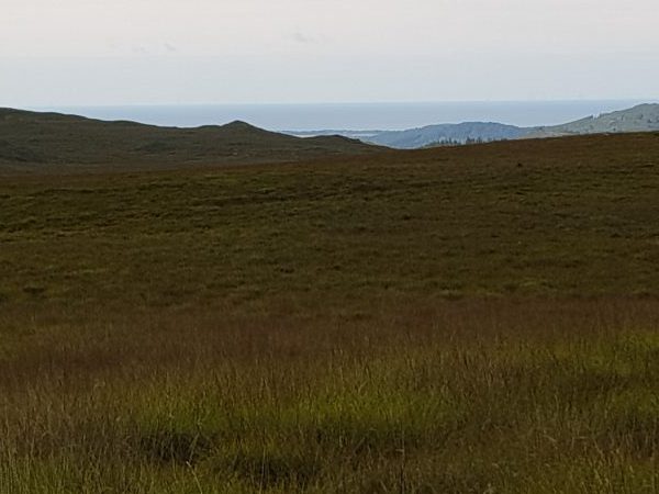
The attraction for me was the chance to see some of the prehistoric sites just north of Boot. Today the region is a rather damp and unprepossessing tract of moorland, but back in the Neolithic and Bronze ages, it supported a reasonable population who (presumably) found it a pleasant spot to live. Times change. Back then, the sea level in the north-west of England was probably somewhere between 10 and 30m above where it is now. The change is principally because the land has risen rather than the sea level falling. As the weight of ice fell away from the land after the close of the last ice age, say about ten thousand years ago in round numbers, the land bounced back (the technical term being “isostatic rebound“). If you take a map of present-day Cumbria and shade in another 20 metres worth of sea, you find that places like Boot were not so far away from the coast.
Not only that, but the vegetation was quite different. Much larger tracts of land were wooded. It is not yet clear whether the trees formed continuous forest, or were scattered in coppices, clustered around the various tarns and streams. Whichever of these is the case, the landscape back then would look very different from what we see today. This change is partly climatic and partly to do with land clearance – the (fairly recent) adoption of sheep farming in the hills has had the side-effect of considerably reducing the tree cover. Some places have kept a decent amount of woodland, but others have almost completely lost it.
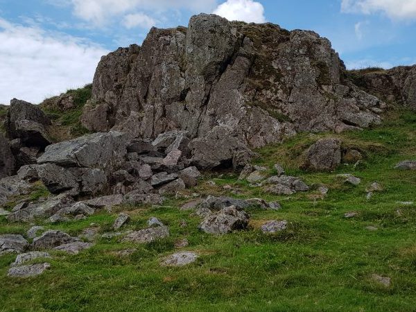
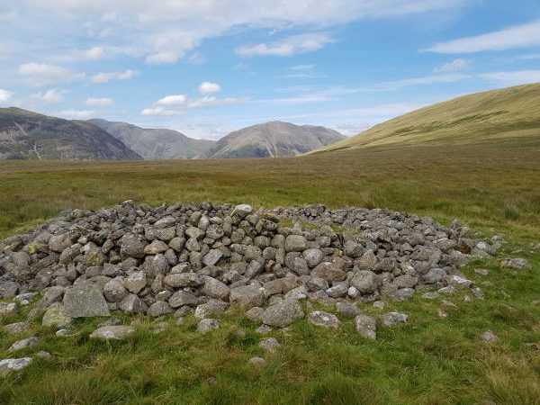
As you climb up from Boot, passing some comparatively recent peat-cutters’ houses, you come up onto the moorland plateau. To your left is a belt of lowland, leading to the Irish Sea. Ahead, if you have picked the correct track up onto Burnmoor, is a large rocky outcrop. It overlooks not just one or two stone circles, but no less than five! The first – Brat’s Hill – is the largest, comprising 42 stones in a 30 metre ring, and containing 5 burial cairns in the interior. Following this are two pairs of two smaller circles – White Moss are closer, and Low Longrigg further away.
Why five circles so close? Did they serve different purposes? Did some fall into disuse and needed to be replaced? Did they belong to different clans or religious groups? Or take turns of importance according to some rota? Were the smaller ones practice rings for children or novices? We just don’t know. Most people assume that the outcrop was used as an integral part of the whole – perhaps to summon people to the place, or address them once there. Was it used for group exhortation, religious ritual, treaty negotiation, or social debate? Whatever the original use, it is often now just called “the altar”. Today, as well as the sea off to one side, the great peaks of Scafell and Great Gable overlook the plateau. It is a magnificent place. Perhaps the stone circles were originally in woodland glades – in which case some of the distant views would not be visible. But my personal suspicion is that the trees stopped well short of this area, and that the long views of mountain and sea were an important part of the experience.
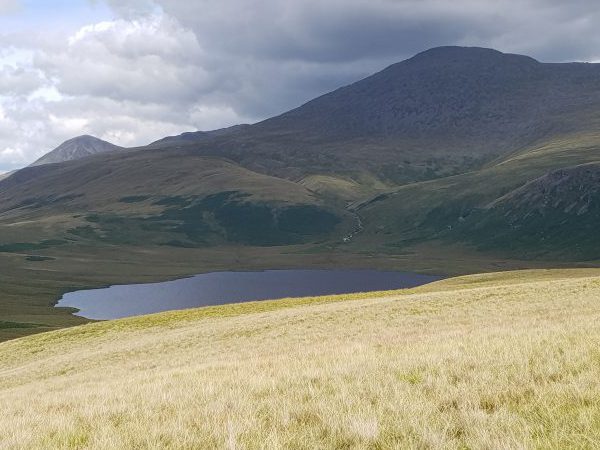
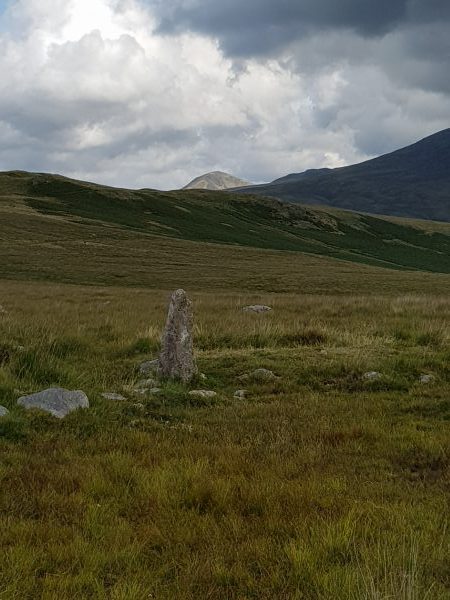
Further on – once you have torn yourself away from the rings and skirted the fringe of Boat How – you get to Burnmoor Tarn, nestling in a hollow of the surrounding ridges and overlooked by Scafell. On the northern side the path goes over a saddle and down into Wastwater. And up in the saddle there is a more substantial ring of stones, called Maiden Castle (as so many of these places are). The stones are about 7m across, and are positioned on a slightly larger dry area, raised a little above the damp moorland. It is almost certainly a burial cairn, and you have to wonder who wanted to be buried here, overlooked not just by Scafell and the Gable, but also several other more northerly peaks which have by now become visible.
From here, I turned back to Boot, but you could go on exploring this plateau for a considerable time. But whether you stay a long or short time, the area leaves more questions than answers in your mind. What were these circles used for? Politics, religion, or just fun? One day, I intend exploring these questions in fiction, with an as-yet-untitled story centred on the stone axe “factory” in Langdale… I now have a working title – Quarry – but not much storyline yet…
>Politics, religion, or just fun?
Or all three? There is a huge overlap between them. This is a fact we’ve seen in action in the last eighteen months in the USA. People don’t change much!
Very true!