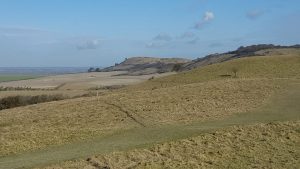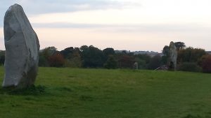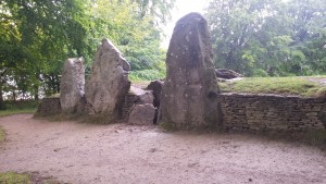
A few days ago I was walking in the Chiltern hills, at the north east end of The Ridgeway. This is often billed as Britain’s oldest road, and is known to have had some 5000 years of traffic going to and fro. I suspect that in fact usage goes back a lot further. Today’s Ridgeway (which is one of our National Trails) goes from Ivinghoe Beacon to Avebury (or the other way), and it is the central part of a really long route which at one time went from The Wash diagonally down to the English Channel. It is possible still to do that, by diligently joining together lots of separate paths – for example The Peddars Way gets you through large parts of East Anglia – but The Ridgeway is the section which is most generously provided with maps and signposts.
Walking on these ancient trackways always gives me a keen sense of those myriads of individuals who have walked that way before. It also invariably gives me a desire to write a story which somehow incorporates the network of paths, their very many fascinating way-stations, and the travellers themselves. But so far I have only a desire, not a plot or anything else substantial.

The Ridgeway is 87 miles long – in practice a little further as you have to come away from the track to find lodgings for the night, and then make your way back in the morning. It’s easy walking, and easy to finish in about a week, or else in a series of weekends with train journeys to and fro. And one of the great things about walking it is that you are covering the ground at the same rate as your remote ancestors. You’re seeing broadly the same terrain as they did (barring houses and a definite lack of trees), watching distant rises and dips in the ground approach at the same slow speed as they did, and experiencing the sun wheeling overhead from east to west in the same way.
Now, our ancestors had different motives for walking these paths than we do. We walk for recreation and inspiration, while for them, motives of trade, diplomacy, marriage, or religious festivity would be at the core. There are all kinds of monuments spread out along the paths. We understand the purpose of some of them, but others have become obscure. We wonder at the prodigious effort involved, but cannot any more grasp the function.

It’s also worth remembering that the various sites and signs of occupancy spread out along the 90-odd miles of The Ridgeway, let alone the much longer distance of the whole route, are themselves spread out over time. It’s easy to forget this, and imagine that a Neolithic, or a Bronze Age traveller, would be seeing the same things as you are. But the reality is quite different. There are Neolithic sites like Wayland’s Smithy, dating from about 5-6000 years ago. There are Bronze Age sites like Avebury or the Uffington WHite Horse. To the people who built these – which are themselves separated by a great gulf of time – Wayland’s Smithy was already unthinkably old. Then there are Iron Age forts, ditches, and banks – and the builders of these would have lost all sense of the earlier constructions as living sites. They would simply have been relics from the past, part of the context of the new homes and sacred sites.

It was this sense of a multi-layered land which was part of the inspiration for Half Sick of Shadows. This did not take place along The Ridgeway, but in a winding river valley. A chalk scarp overlooked the river, and the various human homes nearby, but there are many parts of southern England where that could happen. So that story is not tied to The Ridgeway – but the idea of the land changing slowly, witnessing the rapid passage of generations, was absolutely there. And in that story, there is someone for whom the changes in the land itself seem quick.
